Fig. 3. Section of the map showing parts of southern Greenland and eastern Canada, prepared by Resen 1605 as a copy of Stephanius’s map from 1570, here reproduced after a re-drawing dating from 1886.
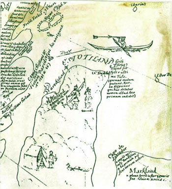
Fig. 3. Section of the map showing parts of southern Greenland and eastern Canada, prepared by Resen 1605 as a copy of Stephanius’s map from 1570, here reproduced after a re-drawing dating from 1886. |
|
|